
EXPLORE NEARSHORE DATA FROM THE SOUND
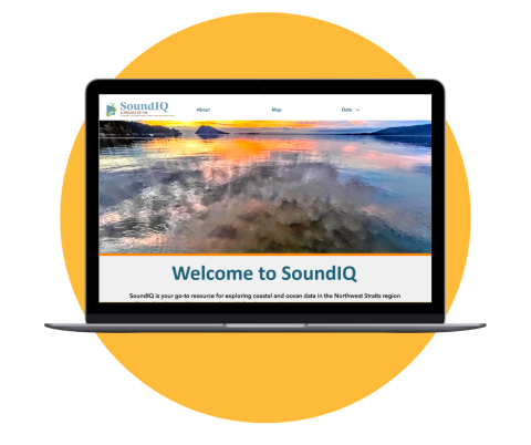
SoundIQ is an interactive, map-based tool that lets you discover, explore, and download spatial data for nearshore species and habitats, like kelp and eelgrass beds, and more. SoundIQ is supported by the Northwest Straits Commission to share data collected by local Marine Resources Committees (MRCs). The goal of SoundIQ is to make Northwest Straits regional data easily accessible and useful to a variety of users. We hope you’ll use SoundIQ as your go-to resource for exploring coastal and ocean data in the Northwest Straits region!
Originally released in 2012, the tool now features a fresh new design and enhanced visuals, making it easier to explore MRC and Northwest Straits Commission geospatial species and habitat data. Please contact email soundiq@nwstraits.org if you notice issues or glitches with the new launch.
COASTAL DATA FOR THE NORTHWEST STRAITS REGION
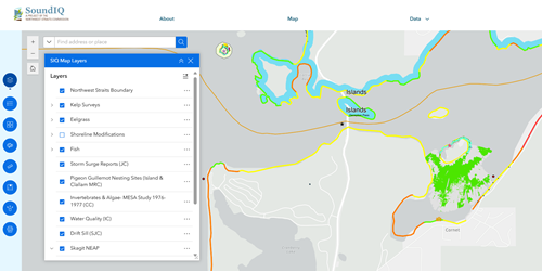
SoundIQ is a collection of geographic data and interactive maps from all seven Northwest Straits counties. It helps users better understand and manage coastal areas. The tool supports decision-making for government agencies, researchers, and the public providing information to plan, assess, and manage coastal resources and risks.
What can you do with SoundIQ?
- Access data from all over the Northwest Straits
- Learn about projects
- Find MRC data and reports
- View and change visible map data layers
- Print or share a map
- Search and download data
- Get inspired to fill additional data gaps
Fun Facts!
- Kayak-based bull kelp monitoring data available
- SoundIQ and associated apps are customizable to your needs, let us know how'd you would like to use MRC data for communicating about your projects.
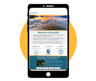
- For the best experience please view on desktop or tablet.
- The mobile version will be optimized in the next phase of the project.
Questions or feedback about the update can be directed to soundiq@nwstraits.org
If you are an MRC member interested in getting project data on SoundIQ please reach out to your MRC staff and Dana Oster.
SoundIQ is maintained and operated by the Northwest Straits Commission. It displays and shares spatial data collected by Marine Resource Committees (MRCs) from Clallam, Jefferson, Island, Skagit, San Juan, Snohomish, and Whatcom counties, along with many dedicated partners.
Additional Resources
Getting Started with SoundIQ
- Go to SoundIQ
- How to video: Main Map
- How to video: Kelp
- How to video: Storm Surge
- How to video: Export Data
- How to video: Access Layers From Your Map
Partner Resources
- DNR Floating Kelp Forest Indicator for WA State
- Environmental Response Management Application (ERMA)
- Marine Vegetation Atlas
- NOAA Sea Level Rise and Coastal Flooding Impacts Data Viewer
- Puget Sound Eelgrass Monitoring Data Viewer
- Puget Sound Institute Encyclopedia of Puget Sound Maps & GIS
- Washington Coastal Atlas